- HOME
- Business Outline
- ICT and Geomorphic
ICT and Geomorphic
|
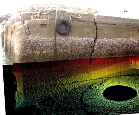
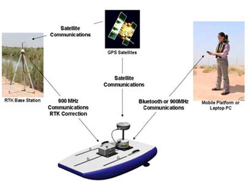
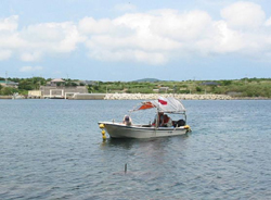
・Aquatic structure ・Geomorphic investigation by detailed echo sounding ・Geological survey ( sonic , magnetism) ・Shoreline survey (coastal landform, Longitudinal and cross-section surveying ) ・Control point survey, leveling, flat plate survey |
||
| ・ADCP and multi-beam ・Drawing bathymetric map, isobath diagram and longitudinal section/cross-sectional drawing ・Drawing and correction with all-purpose CAD ・Output of 3D bathymetric chart |
|
||
|